Fish Scale Diagram
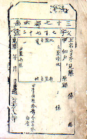
A Page from The Fish Scale Diagram of the Wan Li Period (1572-1620) in the Ming Dynasty
During China's history, very few nationwide land measurements are reported to have taken place; the most important one could be the one conducted in the Wan Li period of the Ming Dynasty.
Based on the data from the measurement, the imperial government was able to determine the amount of land owned by each taxpayer, and create permanent identifications, this became the basis for the levy of the land and poll taxes.
The information from the measurement was kept in every county with each piece of privately held lands mapped and outlined. The entire map of a county looked like it was covered with scales. People used to call them the Fish Scale Diagrams.
The land measurement data from the Ming Dynasty was used in the Ching Dynasty and even in the Republican period.
Return to The Land & Poll Tax